Tamil Nadu Doesn't Get a Weather Story — It Gets a Flood Exam. Here's the Prep
From CM-level disaster reviews to Chennai channel desilting, Cauvery basin works and an El Niño advisory panel — how Tamil Nadu is bracing for monsoon risk.
Tamil Nadu does not get to treat the monsoon as a weather story. Southwest rains, the heavier Northeast monsoon, cyclones and sudden cloudbursts decide whether streets flood, reservoirs hold, power stays up and drinking water lasts. After the 2026 election, Revenue and Disaster Management under Minister K.A. Sengottaiyan became one of the portfolios to watch — because preparedness is judged before the first red alert, not after.
This guide explains the standing machinery and the concrete steps taken so far — written so it stays useful whenever the next rain spell arrives.
Why the monsoon is a governance exam
Tamil Nadu sits in a peculiar hydrological corner of India. The state receives most of its annual rainfall from the Northeast monsoon — roughly October through December — not from the summer southwest system that dominates headlines in Kerala and Karnataka. That inversion matters politically. A “normal” southwest season can still leave Chennai dry in June, then drowning in November. A weak southwest can mean water stress in August and a violent northeast that dumps a month’s rain in forty-eight hours.
The India Meteorological Department (IMD) divides the year into these two engines. Southwest monsoon winds carry moisture from the Arabian Sea across the Western Ghats into Tamil Nadu’s interior — important for the Cauvery basin and hill districts, but often lighter than what Kerala receives. Northeast monsoon winds, by contrast, pull moisture from the Bay of Bengal. When a low-pressure system stalls off the Coromandel coast, Chennai and the northern districts can absorb rainfall totals that overwhelm even well-designed drains. Cyclones — Michaung in December 2023 being the most recent civic trauma before the 2026 election cycle — add a third layer: wind damage, storm surge and compound flooding when rain meets high tide.
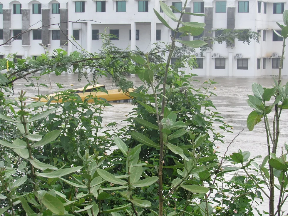
Citizens do not need a meteorology degree to understand the stakes. They need a government that treats TNSDMA meetings as operational orders, not photo opportunities — and a Revenue department that can move SDRF teams before water crosses the threshold, not after television crews arrive.
The memory that shapes every budget line
December 2015: when Chennai became a flood laboratory
The December 2015 floods remain the reference event for urban disaster politics in Tamil Nadu. After weeks of intermittent rain, a concentrated burst in early December — combined with reservoir releases, blocked waterways and inadequate stormwater capacity — left large parts of Chennai under water for days. Velachery, Adyar, Tambaram and pockets of the IT corridor became symbols of a city that had grown faster than its drainage.
The aftermath produced commissions, court interventions, stormwater project announcements and a civic vocabulary every resident now shares: desilting, bottleneck removal, missing links, pump capacity. No minister responsible for disaster management in the 2020s can speak about monsoon work without the 2015 benchmark hovering in the room. Sengottaiyan, a nine-term MLA who has seen multiple governments from the inside, inherits that benchmark explicitly — voters in Gobichettipalayam and flood-prone wards in Chennai will ask the same question: Did you desilt before November?
December 2023: the northeast spell that would not stop
Before the 2026 election, December 2023 offered a fresh stress test. A prolonged Northeast monsoon spell brought repeated heavy rainfall across northern Tamil Nadu. Chennai did not replicate 2015’s full catastrophe, but several neighbourhoods reported prolonged inundation, power outages and commuter paralysis. The spell reinforced a lesson planners already knew: short intense bursts on already-saturated ground behave differently from steady rain. Stormwater networks that handle average days can fail on peak days — and peak days are arriving more often in public memory.
Cyclone Michaung: wind, surge and compound failure
Cyclone Michaung, which made landfall in December 2023, added cyclonic wind and storm-surge logic to the northeast-rain story. Chennai airport suspended operations; trees and power infrastructure fell across the metropolitan region; coastal and low-lying areas faced combined wind-rain-tide risk. Michaung did not replace 2015 as the dominant civic metaphor, but it reminded the state that cyclone preparedness and urban flood preparedness are linked files — the same Revenue department, the same 24×7 control rooms, the same question of whether weak transformers were fixed in October.
Preparedness is never “done.” It is a calendar: desilt in summer, review before onset, staff through landfall, audit after the water falls.
These three events — 2015, December 2023 rains, Michaung — form the historical backdrop against which the TVK government’s 2026 monsoon orders will be graded. The machinery below is not abstract doctrine; it is the institutional response to repeated failure modes citizens already name in ward meetings.
The command structure
The Tamil Nadu State Disaster Management Authority (TNSDMA) is where departments stop working in silos. Early in the southwest monsoon season, Chief Minister C. Joseph Vijay chaired a preparedness review with Secretaries, the Chief Secretary and Collectors from Western Ghats districts (many on video). The India Meteorological Department’s outlook at the time pointed to below-normal southwest monsoon rainfall for the state — which sounds like “less flood risk,” but often means a nasty mix: water stress in some months, intense short bursts and a still-dangerous Northeast monsoon later.
That below-normal southwest signal is precisely why veteran disaster administrators worry about complacency. Less rain in July does not mean less rain in November. It can mean reservoirs drawn down for drinking water, soil hardened by dry spells, and then sudden cloudbursts on catchments that no longer absorb water efficiently. The Western Ghats districts — Nilgiris, Coimbatore, Theni, Dindigul and neighbours — face landslide and flash-flood risk when southwest bursts arrive on steep terrain. Collectors joining the CM’s review by video link was not ceremonial; those districts maintain separate SOPs from Chennai’s canal logic.
Orders that come out of these meetings are familiar but necessary:
- Keep district emergency centres open 24×7
- Hold SDRF, Fire & Rescue, police and health teams ready to move
- Maintain relief centres with basic stocks
- Monitor reservoirs and regulate releases through the Water Resources Department
- Fix weak poles, lines and transformers before storms bring them down
None of that is new doctrine. The test is whether collectors and line departments treat it as routine discipline — whether relief centres listed on paper have cots, drinking water and functioning toilets when the first busloads arrive.
Chennai: drains, channels and short-term works
Chennai’s flood memory is long — and residents in places like Velachery still measure governments by whether pumps and stormwater gaps are fixed before November. In 2026, the Water Resources Department (WRD) moved on two tracks:
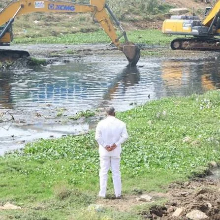
- Special desilting drives on vulnerable waterways and reservoir catchments (including support from NGOs and CSR where formal work orders lagged).
- A package of about 20 short-term flood-mitigation projects in the Chennai basin — bottleneck removal on channels such as the Cooum, flood-protection walls on stretches including the Araniyar and South Buckingham Canal, causeway/bridge removals that obstruct flow, and flood regulators on restored water bodies in areas such as Sriperumbudur and Avadi.
Officials have discussed works in the order of ₹400 crore for broader proposals, with priority jobs pushed through the State Disaster Mitigation Fund when full Budget clearances take longer. The honest civic caveat, reported widely in the city press: ambitious multi-year stormwater projects and missing drain links will not all finish before every monsoon. Short-term desilting and bottleneck removal are the bridge.
The city sits on a flat coastal plain threaded by three major rivers — Cooum, Adyar and Kosasthalaiyar (Araniyar) — and canals including the Buckingham Canal. Ennore and the northern industrial belt, where port and thermal infrastructure meet marshland, face a different flood profile from south Chennai’s lake networks — but both depend on the same principle: water must have somewhere to go when pumps cannot keep pace. Causeway and bridge removals target the roads built across channels where water used to flow; flood regulators in Sriperumbudur and Avadi reflect retention before release logic that gained currency after 2015’s reservoir-gate debates.
Beyond Chennai: the Cauvery basin lesson
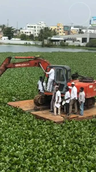
For years, “pre-monsoon work” in public debate meant the capital. After flood damage in delta districts — including lessons cited from Cyclone Ditwah impacts in 2025 — WRD began extending preventive maintenance into the Cauvery basin, covering districts such as Tiruchi, Pudukkottai, Mayiladuthurai and Nagapattinam.
Parallel summer desilting across a long canal network (thousands of kilometres in the wider programme) is meant to keep water moving to the tail end and reduce overbank spills. Farmers have asked for exactly this kind of routine clearance; the administrative shift is treating the delta as a flood system, not only an irrigation system.
The delta’s risk is overbank spill when channels carry both irrigation releases and monsoon runoff. Tail-end farmers in Nagapattinam and Mayiladuthurai have protested when upstream blockages leave them with flood damage but no irrigation benefit. Cyclone Ditwah’s 2025 impacts reminded planners that coastal storms push saline ingress deep into delta agriculture — summer canal clearance is cheaper than post-flood compensation, but only if finished before the northeast onset.
Northeast monsoon science: what citizens should know
The Northeast monsoon accounts for roughly 48 percent of Tamil Nadu’s annual rainfall, concentrated in a shorter window than the southwest. IMD defines the season from October to December; some heavy spells extend into January. Key mechanisms:
- Bay of Bengal depressions that deepen into cyclones or slow-moving rain systems
- Retreat monsoon interactions when northeast winds meet residual moisture
- Orographic lift in the Eastern Ghats and Western Ghats fringes, producing localized cloudbursts
Below-normal southwest rainfall — as flagged in the 2026 season outlook — does not cancel northeast risk. El Niño and La Niña phases modulate both seasons differently; that is why the state constituted a dedicated expert committee rather than relying on a single IMD bulletin.
Citizens should follow district collector bulletins and IMD’s nowcasts during active spells, not forwarded WhatsApp maps with unverified colour codes. Chennai’s flood risk peaks when rainfall intensity exceeds about 50 mm in three hours on saturated ground — a threshold emergency planners use internally even when public messaging stays plain-language.
El Niño watch and drinking-water contingency
In late July 2026, the Revenue and Disaster Management Department issued a Government Order constituting an Expert Advisory Committee to monitor a possible strong El Niño and advise the Tamil Nadu Disaster Risk Reduction Agency on early warning, drought and flood mitigation. The committee’s working window covers 2026–27 and 2027–28 — a multi-season scientific backstop, not a one-week task force.
At the same time, rainfall-deficit worries triggered an order in the range of ₹340 crore to augment drinking-water sources so cities and towns are not caught between a weak southwest season and a volatile northeast season. Flood preparedness and drought preparedness are not opposites in Tamil Nadu; they are two chapters of the same manual. Municipalities entering the northeast with depleted reservoirs may face impossible choices if a heavy spell demands gate operations for flood control while tanks are already low for supply.
What households and local bodies should do every season
Government machinery fails less often when citizens and wards act on a checklist:
- Know your ward relief centre and helpline before water rises.
- Report blocked stormwater inlets early — not on the day of inundation.
- Keep documents and medicines in waterproof pouches if you live on a known flood street.
- Treat downed wires as live; call TANGEDCO, do not “fix” them.
- Apartment associations: clear terrace drains and basement pumps before the forecast week.
- Follow IMD and district collector bulletins over forwarded WhatsApp maps.
How this fits the rest of the 2026 agenda
Disaster readiness sits beside the Budget’s infrastructure and welfare story. A state can announce school modernisation and skill missions, then lose a week of economic life to preventable urban flooding. That is why monsoon work belongs in the same citizen briefing as schemes and post-election changes.
The Chief Minister’s Integrated Urban Development Mission — with its envelope for water supply, sewerage and AI-enabled city management — only delivers if flood-season basics work first. SPEED building approvals and Metro Phase II commissioning mean little to a commuter standing knee-deep on GST Road during a November cloudburst.
Minister Sengottaiyan’s portfolio connects directly to the cabinet map: Revenue collects the disaster data, coordinates relief, and interfaces with collectors who are the state’s field commanders. His nine-term experience is an asset if deployed for pre-season audits, not only post-disaster press conferences. Chief Minister Vijay’s decision to chair an early preparedness review signals the issue sits on the CM’s desk — appropriate for a mandate won partly on credibility that government will show up before the crisis.
Preparedness is never “done.” It is a calendar: desilt in summer, review before onset, staff through landfall, audit after the water falls. The 2026 government has put the reviews, committees and channel works on record. The rains will grade them.